You may have heard the term 10/40 Window. In case you haven’t, it is a rectangular area that covers the entire Eastern Hemisphere (North Africa, the Middle East and Asia) from 10 degrees to 40 degrees north latitude. It originated in 1990 as a result of a serendipitous connection between Luis Bush, who was then CEO of Partners International, and Pete Holzmann the same day Pete’s team finished creating the first PC GIS.
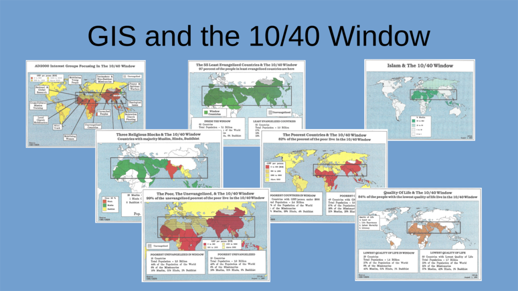
Luis asked Pete to use the GIS to discover what might be significant about that general part of the world. Pete created a “10/40 Box” and used GIS tools to analyze a variety of variables. They ended with half a dozen surprising insights. Perhaps most significant, close to 100% of those who are poorest of the poor and have little or no access to Christian resources all live there (in 1990.) Pete made maps and Luis wrote an article.
But the story wasn’t finished until a few weeks later. On a personal retreat, Luis and his wife Doris had a revelation: this area isn’t a Box, it’s a “Window of opportunity.” And thus the 10/40 Window was born. You can see some slightly later (2006) versions of these maps here. The maps gave a great visual picture of the physical and spiritual needs in the area reinforcing the concept. Many people used these maps and their successors to show these needs.
Some helpful weblinks:
Pete Holzmann helped provide the details in this article.